Agremo Eagle Eye Report is designed for Ag professionals to help them create a visual plan of their field by determining the size of field areas, identifying problematic areas, arable areas, and more. With an eagle eye report, you get a detailed list of all points of interest on your map with their latitude and longitude, which can include trees, rocks, irrigation systems, and other. It also allows you to precisely calculate the exact distance between specific points on your field, like the distance between roads, plants, rows, fields, etc.
Corn grower can save up to $300 / acre
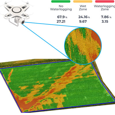
Corn grower can save up to $300 / acre by measuring the true arable area fit for the cultivation, and compare it with the cadastral area. They will save money on input planning for the difference between the cadastral and actual arable area. E.g. cadastral area is 100 acres, but some objects, power lines, irrigation channel, pond etc., are accumulating total of 3 acres. Grower won’t sow nor plan inputs for those 3 unarable acres.
One of the advantages of eagle view reports is the fact that they can be utilized throughout the year – regardless of the time in crop season, the possibility to visually depict points and field areas on the field map can help to optimize yields and save resources.
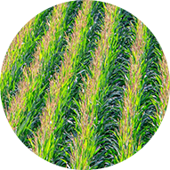
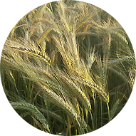
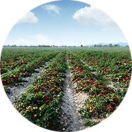
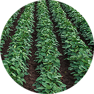
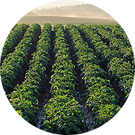
The report makes it possible to create a visual plan of the entire field that you plan to cultivate. As a result, all crops benefit from eagle view reports, including vegetables, plantation, forestry, and field crops.


No credit card required

Agremo's AI solution turns DJI's drone imagery into actionable insights, and its recipe maps make our AGRAS drone a truly intelligent and precise spraying tool." The integration of the Agremo platform between Agremo and the DJI drone is a turnkey solution for precision agriculture.
DJI Agriculture

As markets become more defined and customer expectations are increasingly specific, Black Gold believes that we must develop greater awareness of how our crops function. Agremo provides a new window into understanding what is happening in our fields at a more granular level and how to move the needle in the best direction.
Bryan Bowen

Agremo helps us better understand and adjust to changes throughout the growing season. The flexibility and agility the Agremo team has shown through their platform enable us to adjust and meet changing demands due to weather or pest developments as the season progresses. In addition, the Agremo team consistently listens to feedback to ensure that everything works as described for our specific use cases.
John Glick
After introducing mapping and crop analysis reports to farmers, they could see their field from another perspective. Agremo is helping us bring essential information to farmers which were impossible to get until recently.
Ramón Pagán

Agremo’s map is more specific. Competitors break their maps into half-acre grids, but Agremo colors the whole thing exactly how it is. Visually, it’s night and day. A lot of farmers are visual.
Corey Nohl

With Agremo reports, farmers they can increase productivity, reduce major problems by having early warnings during the early stages of the crops preventing major losses. Bottom line, increase ROI while minimizing losses.
Miguel Ángel Salgado

The best thing about the plant population reports is the accuracy, which is splendid and it is very important! Great service at eye level with the customer!
Sune Enevoldsen
Field Manager and Drone Operator @ Noble Nordmann // Denmark

The biggest benefit for farmers who use drones and Agremo reports is that they increase their yields, reduce costs or improve their productivity. In the end, all these benefits are lead to extra profits.
Ciprian Iorga

We introduced new farming methods to farmers in Africa, who recognized that Agremo and drones can provide them with quicker, more convenient, efficient and accurate way of gathering decision making information.
Derrick Annan

With Agremo, we doubled our productivity, and our forestry clients are happy with the Agremo reports necessary for the inventory system as well as a stem map with tree distribution.
Curt Rogers

Of the few vendors who advertised drone imagery analytics, Agremo provided a vastly superior capability. It is extremely important to base any remote sensing assessment in solid ground truth. Agremo clearly excelled over their competitors.
Konrad Kern
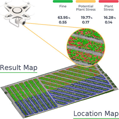
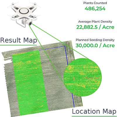
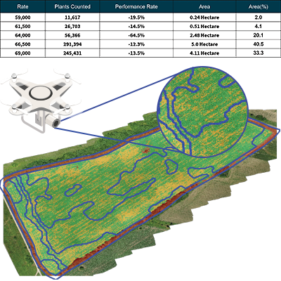
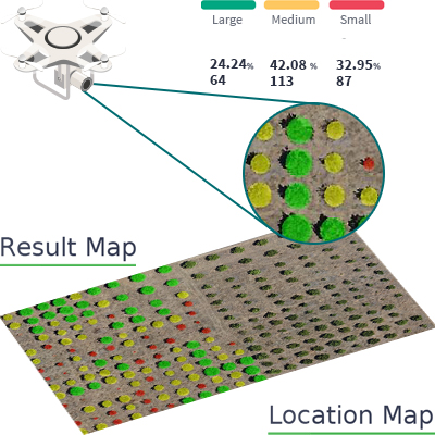
Agremo Stand Count analysis shows how successful seeding was and how many plants farmers will be able to harvest. Withal, it can help to apply different sowing standards in different parts of the plot, in order to achieve the highest yields.
Zdravko Hojka
Agroservice and Product Manager (Maize and Oil Crops), KWS SAAT AG

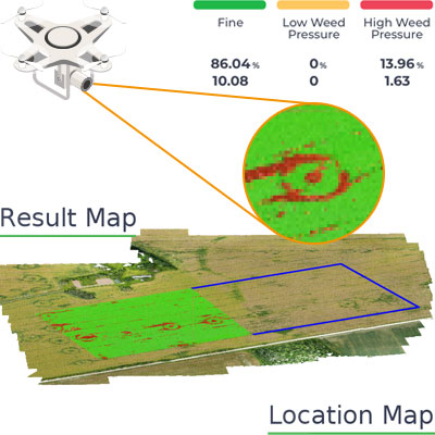
Since we ran our first report with Agremo, both our company and our customers continue to be impressed with the accuracy of the reports compared to our ground truthing. We have leveraged many Agremo reports but find the most value in crop health, weed and stand count analyses. We continue to leverage the Agremo intelligence as a proven way to improve our customers’ bottom line.
Jeff Buyck
Free demo - no credit card required