How to copy annotation on the same map
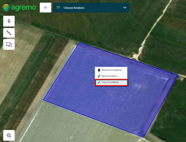
Select the annotation which you would like to copy and then select Copy Annotation from the menu (right mouse click).

To paste the annotation, select Paste Annotation from the menu (right-click).

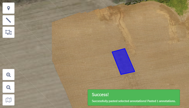
After copy/pasting the annotation, a message will appear.
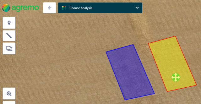
The copied annotation is positioned over the original annotation.
Therefore, in order for you to use the copied annotation, it is necessary to drag it to the desired position.

Clicking (left click) on an annotation, a Drag & Drop button will appear. Drag & Drop button appears in the place where we clicked on an annotation.
After that, just drag and drop the annotation to the desired position.
This feature is particularly useful for creating micro-plots or uniformed rows.
How to copy the annotation on a different map
Select the annotation which you would like to copy, then select Copy Annotation from the menu (right mouse click).
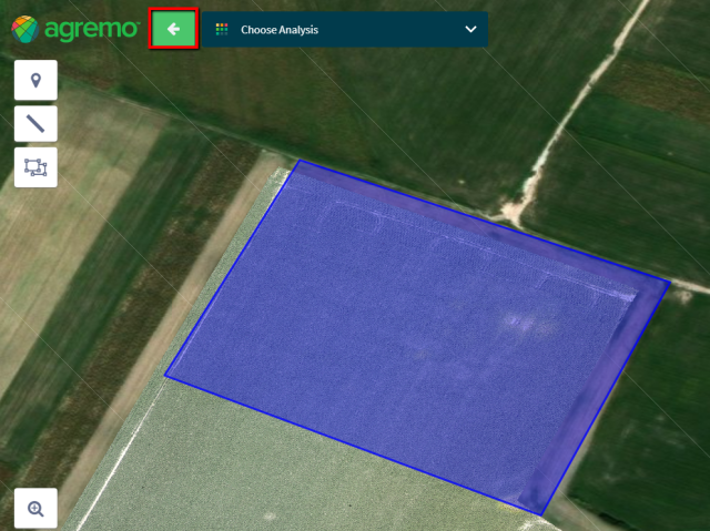
Click the back button in the upper left corner.
Choose the map where you want to paste the copied annotation.

When you enter the selected map, select Past Annotations from the menu (right mouse click).

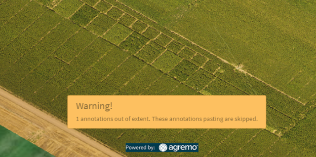
After successfully copy/pasting the annotation, a message will appear.

Copy/pasting of an annotation to a different map is only possible if the maps have the same geo-location. If maps have different geo-locations, the user will receive a message for unsuccessful copying of annotation.