Ground truthing is an important part of the field survey. Good collected ground truth means more accurate analysis results. Ground truth is very important for the detection of specific phenomena such as weeds, disease, pests, stress…
What is the ground truth?
Ground truth is a method of collecting digital information about the condition of the crop and field in general. The information is collected at a particular location and it is used as an addition to the remote sensing data collected by a drone.
How to collect good ground data?
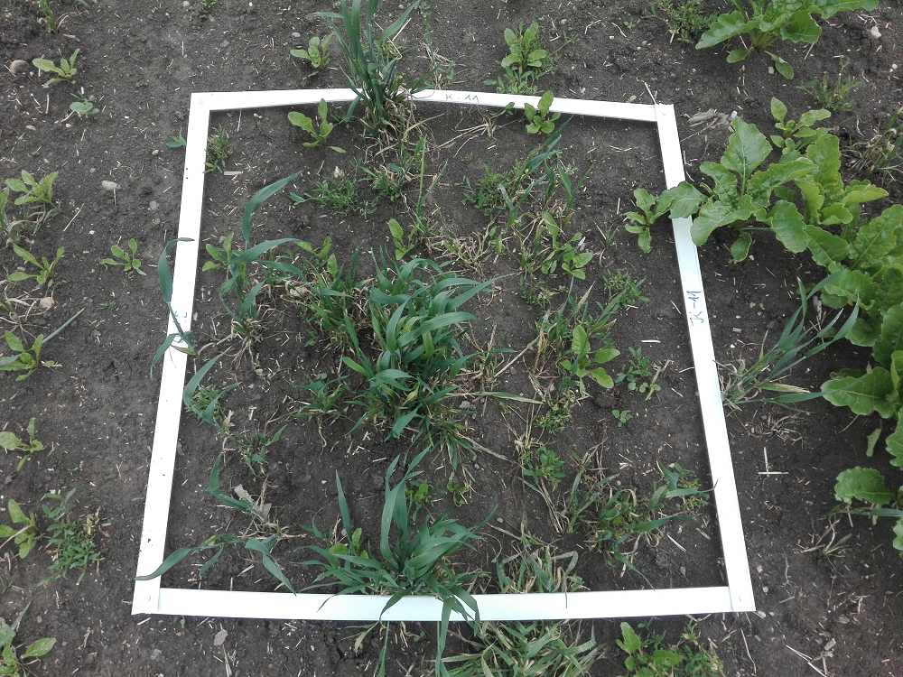
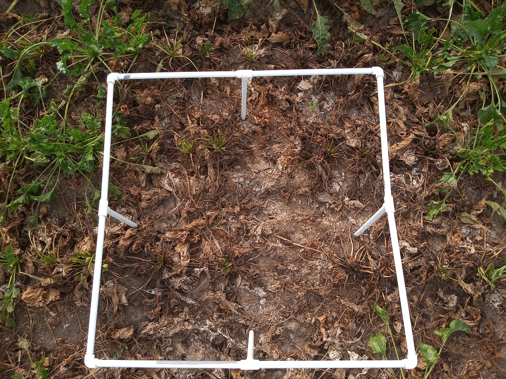
The best way to collect ground truth is to put a marker on phenomena you want to detect and take a picture from above with a mobile device. Placing a marker will allow you to easily find that position on a map and mark it with a location tool on the Agremo app.
You can mark bad parts of the field as well as good parts of the field
Types of markers you can use:
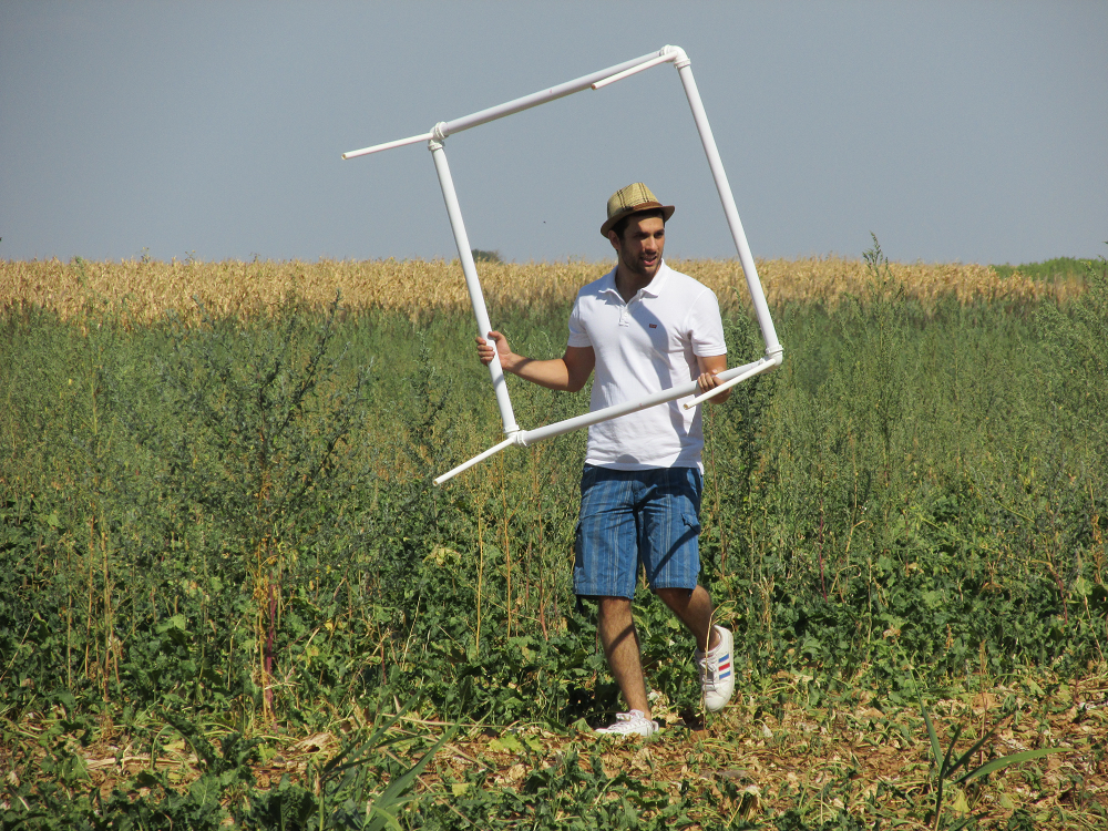
1×1 meter square marker (Made of PVC ducts)
1×1 meter square marker (Made of PVC pipes)
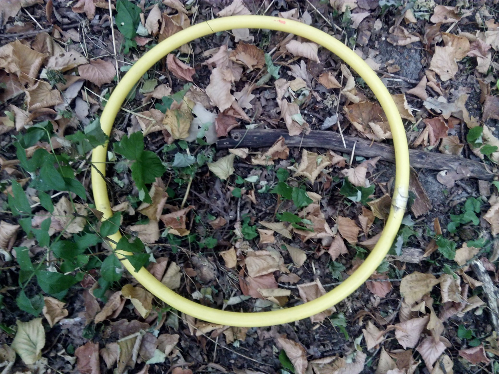
Circle marker (hoop)
Or any other type of marker
Or any other type of marking the phenomena which will be noticeable on the map.
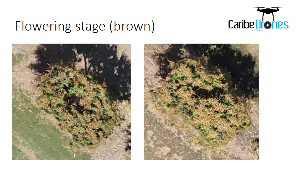
When you need to ground-truth orchids, you can take an image with your drone.
Also, you can take an image and mark the geolocation (with a geolocation apparatus or with a geolocation application ) of the place where the image was taken. Then you can find that geolocation directly on the Agremo app.
TIPS: The width of the PVC pipes or ducts for square markers should be twice as wide as the target GSD (at least 5 cm or 2 in). This also applies to the hoop-shaped marker.
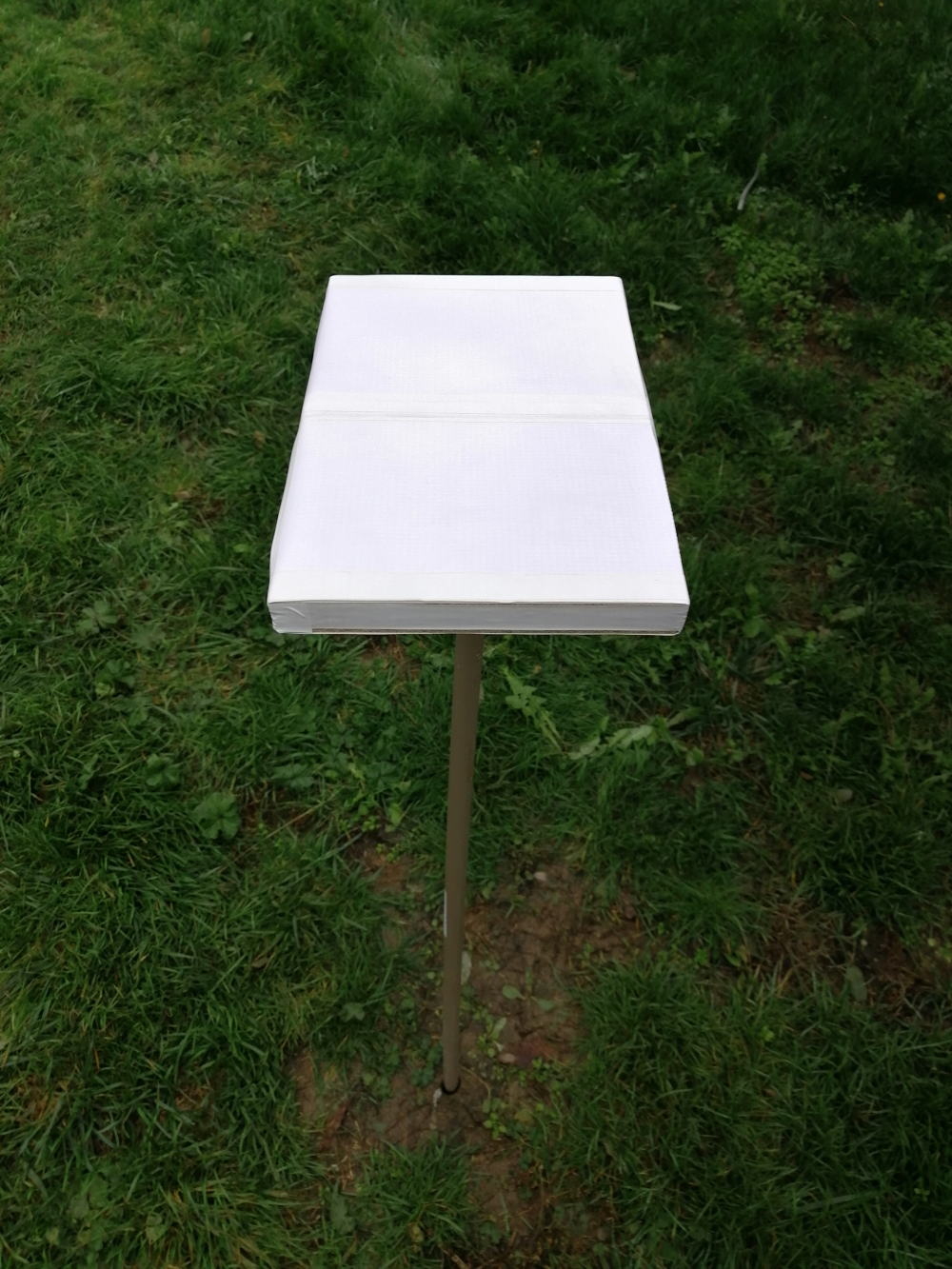
When crops are in later growing stages PVC markers with stands are needed.
How to add ground truth images to the Agremo app?
Once you have collected ground truth images, you can easily add them to the Agremo app which will improve the analysis process and make it more accurate. You can add ground truth images via location pin or via polygons (annotations).
When you mark the desired position on the map with the location tool, a pop-up window will appear. Now you can enter a title, comment, and upload a picture you took on a field.
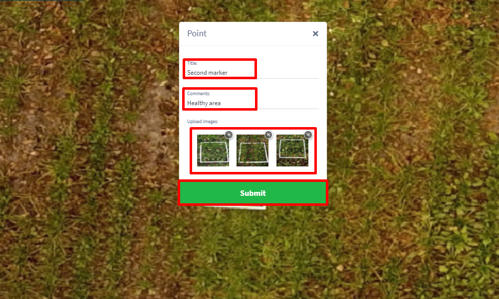
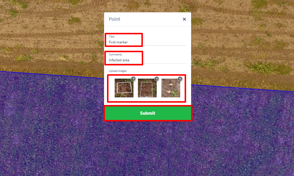
You can mark bad parts of the field as well as good parts of the field.
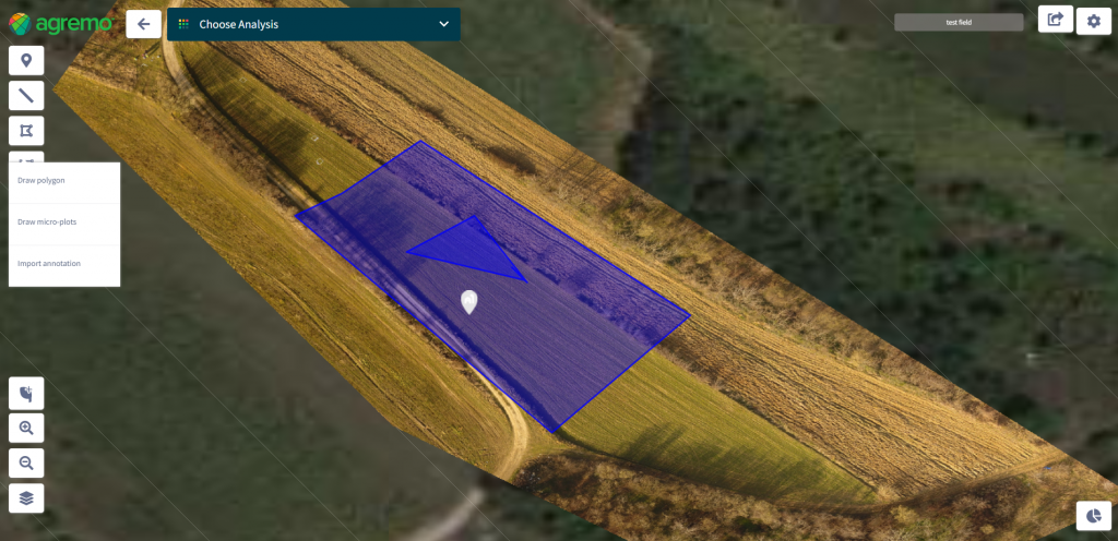
Another way to add ground truth images is via polygons (annotations). The first step you need to do is to select the area of the field you want to analyze by drawing a polygon in that area. Within that polygon, you need to create another polygon and there you can add the ground truth images of that area before requesting an analysis.
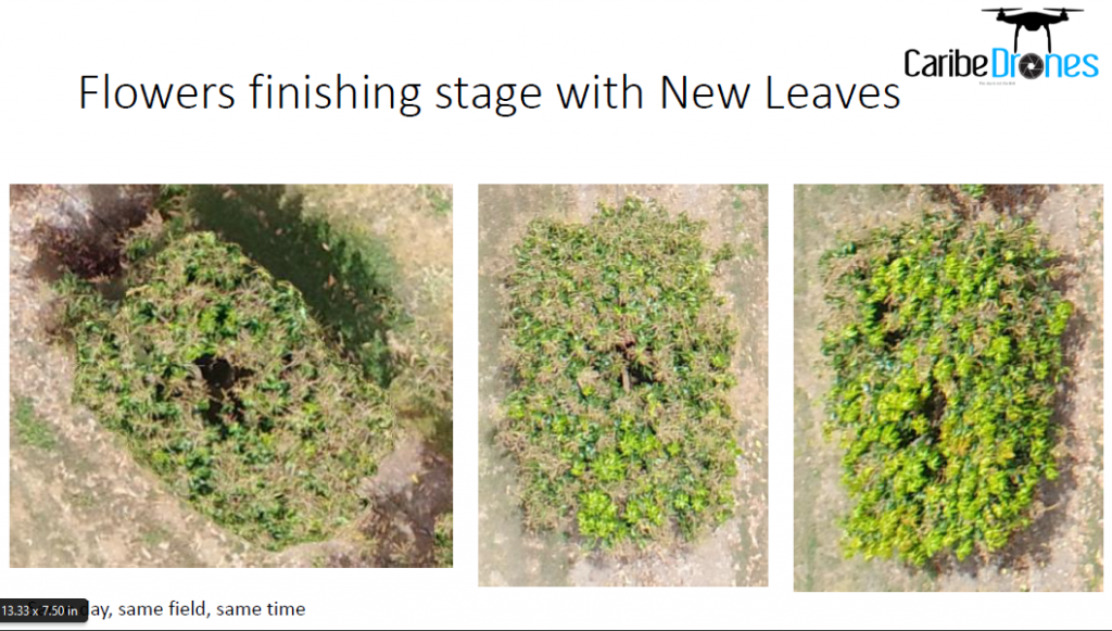
On the images below, you will see an example of using ground truth images: