Monitor your fields with Satellite Field Monitoring & Early Crop Alerts, powered by satellite vegetation indices, including NDVI, NDRE, NDWI, RECI, EVI, MSAVI.. Detect early crop emergence, track growth progress, and identify stress changes across your fields before they become visible. Receive automated early alerts for crop emergence, stress, and vegetation changes detected via satellite NDVI monitoring. Pinpoint exact field locations and affected zones to act faster, reduce yield risk, and improve decision-making with continuous satellite field monitoring for precision agriculture.
Monitor your fields with Satellite Field Monitoring & Early Crop Alerts, powered by satellite vegetation indices, including NDVI, NDRE, NDWI, RECI, EVI, MSAVI.. Detect early crop emergence, track growth progress, and identify stress changes across your fields before they become visible. Receive automated early alerts for crop emergence, stress, and vegetation changes detected via satellite NDVI monitoring. Pinpoint exact field locations and affected zones to act faster, reduce yield risk, and improve decision-making with continuous satellite field monitoring for precision agriculture.
Early Alerts. Faster Decisions.
Stop discovering crop issues when it’s already too late.
Monitor every field from space and receive instant alerts when changes in crop emergence, vigor, or stress are detected.
Satellite monitoring automatically tracks crop development and vegetation changes across every field. When unusual NDVI changes are detected, the system generates an alert and highlights the exact location and affected area.
Instead of scouting entire fields, growers can focus only on high-risk zones, identify issues earlier, and take corrective action before yield losses occur. This reduces unnecessary field visits, saves time, and enables more effective crop management throughout the season.

Turn satellite data into actionable field intelligence with automated early alerts to detect issues before they impact yield. Agremo continuously analyzes vegetation indices like NDVI to identify critical changes across your fields and highlight exactly where action is needed.
Vegetation Emergence Alerts detect early plant growth or unexpected green-up signals, helping identify delayed emergence or potential weed pressure before the crop development stage is expected.
NDVI Stress Alerts highlight significant drops in vegetation health, indicating crop stress caused by weather, pests, or nutrient issues, as well as monitoring late-season changes as crops approach harvest.
Uneven Development Detection identifies zones within the field where crops are not developing uniformly, providing precise locations and affected areas for targeted investigation and correction.
With satellite-driven alerts, farmers can prioritize field visits, respond faster to emerging issues, and manage variability at scale—reducing risk and improving overall crop performance.


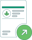
Create your FREE account and instantly unlock all analyses and precision agriculture tools. Start exploring your field insights today.