Agremo at the Drone Spraying Conference 2025

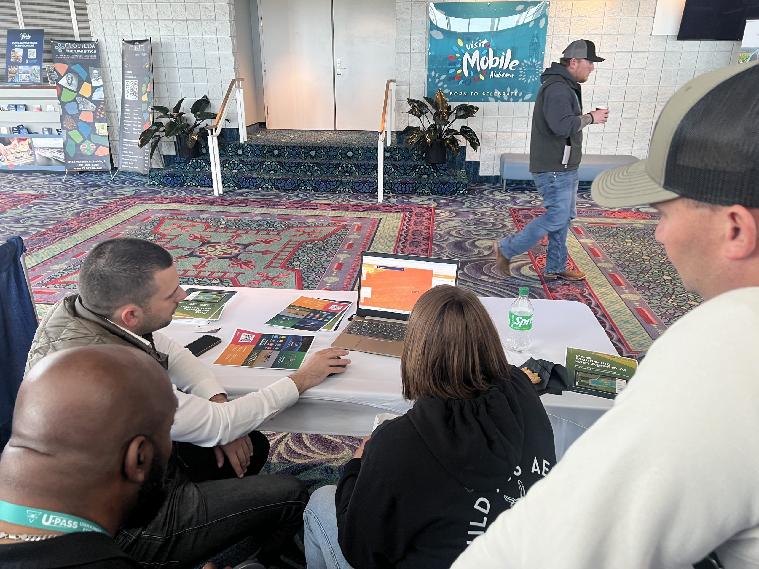
Before this season’s first spray, the Agremo team traveled to Mobile, Alabama, to attend the 3rd Annual Spray Drone End User Conference, the largest gathering of North American agriculture drone users and developers. This drone spraying conference 2025 brought together over 600 professionals exploring the power of drones in transforming modern farming.

Action-Packed Sessions & Game-Changing Insights

The conference featured 24 dynamic sessions covering:

  • Regulatory updates from FAA and EPA,

  • Real-world equipment demos and maintenance tips,

  • Business strategies for drone spraying startups, and

  • Thought-provoking panels with researchers, manufacturers, and seasoned drone operators.

Even drones with smaller payloads are now matching or outperforming traditional crop dusters delivering greater precision, reduced chemical waste, and higher efficiency in the field.

Agremo at the Heart of the Action

Our U.S.-based team engaged with growers, drone service providers, and ag-tech innovators to explore how precision agriculture is expanding, not just on large-scale farms, but also in:

  • Small and mid-sized operations,

  • Non-agricultural sectors,

  • Remote and hard-to-access terrain.

Key takeaway: geography shapes needs. In some areas, stand counts and early plant vigor dominate. In others, it’s about analyzing yield variability or gaining access insights. That’s exactly why Agremo’s platform is built to adapt to diverse fields, crops, and grower goals.

More Than Tools-People Want Partners

Throughout the event, one thing became clear- professionals don’t just want drone tools, they want reliable, knowledgeable partners.

At Agremo, we deliver more than software. We empower users with:

  • Instant drone analytics for stand count, crop health, and prescription maps,

  • User-friendly design that requires no technical background,

  • Quick turnarounds, so you spend less time on screens and more time in the field.

The Road Ahead: U.S. Growth and Long-Term Vision

Our expansion in the U.S. is a cornerstone of our growth strategy. As more ag professionals look for smart mapping and real-time insights, Agremo remains committed to:

  • Supporting the next generation of drone-enabled growers,

  • Building strong reseller and training partnerships,

  • Providing tools that simplify precision decisions.

The energy at the Spray Drone Conference validated what we’ve known all along:

  • The future of farming is precision-powered and drones are leading the charge.
  • We’re proud to play a role in this exciting shift. And trust us, this is just the beginning.

Stay tuned & use Agremo-because the best is yet to come.

Try Agremo Analytics

Free - no credit card required

What Our Clients Say About Us

  • Agremo's AI solution turns DJI's drone imagery into actionable insights, and its recipe maps make our AGRAS drone a truly intelligent and precise spraying tool." The integration of the Agremo platform between Agremo and the DJI drone is a turnkey solution for precision agriculture.

    DJI Agriculture

    Smart Farming Team

  • As markets become more defined and customer expectations are increasingly specific, Black Gold believes that we must develop greater awareness of how our crops function. Agremo provides a new window into understanding what is happening in our fields at a more granular level and how to move the needle in the best direction.

    Bryan Bowen

    Director of Agronomy at Black Gold Farms

  • Agremo helps us better understand and adjust to changes throughout the growing season. The flexibility and agility the Agremo team has shown through their platform enable us to adjust and meet changing demands due to weather or pest developments as the season progresses. In addition, the Agremo team consistently listens to feedback to ensure that everything works as described for our specific use cases.

    John Glick

    CIO at Cochranville Ag Service

  • After introducing mapping and crop analysis reports to farmers, they could see their field from another perspective. Agremo is helping us bring essential information to farmers which were impossible to get until recently.

    Ramón Pagán

    Mapping Expert and President @ Caribe Drones // Puerto Rico

  • Agremo’s map is more specific. Competitors break their maps into half-acre grids, but Agremo colors the whole thing exactly how it is. Visually, it’s night and day. A lot of farmers are visual.

    Corey Nohl

    Drone Operator and Farmer @ Above All Aerial // MN, USA

  • With Agremo reports, farmers they can increase productivity, reduce major problems by having early warnings during the early stages of the crops preventing major losses. Bottom line, increase ROI while minimizing losses.

    Miguel Ángel Salgado

    General Manager & Mapping Expert @ Ansar Drone // Mexico

  • The best thing about the plant population reports is the accuracy, which is splendid and it is very important! Great service at eye level with the customer!

    Sune Enevoldsen

    Field Manager and Drone Operator @ Noble Nordmann // Denmark

  • The biggest benefit for farmers who use drones and Agremo reports is that they increase their yields, reduce costs or improve their productivity. In the end, all these benefits are lead to extra profits.

    Ciprian Iorga

    General Manager @ La Orizont // Romania

  • We introduced new farming methods to farmers in Africa, who recognized that Agremo and drones can provide them with quicker, more convenient, efficient and accurate way of gathering decision making information.

    Derrick Annan

    CEO @ Aeroshutter // Ghana

  • With Agremo, we doubled our productivity, and our forestry clients are happy with the Agremo reports necessary for the inventory system as well as a stem map with tree distribution.

    Curt Rogers

    Co-owner @ TimberDrone // USA

  • Of the few vendors who advertised drone imagery analytics, Agremo provided a vastly superior capability. It is extremely important to base any remote sensing assessment in solid ground truth. Agremo clearly excelled over their competitors.

    Konrad Kern

    Image Scientist @ Falcon Aerial Data // USA

  • Agremo Stand Count analysis shows how successful seeding was and how many plants farmers will be able to harvest. Withal, it can help to apply different sowing standards in different parts of the plot, in order to achieve the highest yields.

    Zdravko Hojka

    Agroservice and Product Manager (Maize and Oil Crops), KWS SAAT AG

  • Since we ran our first report with Agremo, both our company and our customers continue to be impressed with the accuracy of the reports compared to our ground truthing. We have leveraged many Agremo reports but find the most value in crop health, weed and stand count analyses. We continue to leverage the Agremo intelligence as a proven way to improve our customers’ bottom line.

    Jeff Buyck

    VP of Precision Ag C&B

    GET A DEMO

    Free demo - no credit card required

    What precision agriculture reports do you need?

    • Weed Detection

      • spot weed-infested areas in time
      • take immediate effective in-season corrective measures
      • get precise spraying maps
    • Green Snap Detection

      • identify and classify areas with broken plants in the field
      • locate and quantify the crop damage
    • Lodging Detection

      • detect and classify areas with lodged plants
      • locate and quantify the crop damage
    • Stand Count

      • get the precise number of plants in a specific area
      • evaluate seed quality
      • assess field damages
      • know the zones of potential yield losses
    • VRS Stand Count

      • calculate the percentage under the norm in each zone with the same seeding rate
      • reduce input costs in the low-productivity field areas
      • count plants in the best and the worst zones
    • Plant Vigor

      • get data on the exact location, condition, strength, and lushness of vegetation
      • optimize the usage of inputs, save on them and prevent over-application
    • Waterlogging Detection

      • quickly and accurately locate all potential waterlogged areas in your field
      • reduce the negative effects of waterlogging, regardless of the field size and crop sort
    • Canopy Cover

      • get vital data on vegetation conditions and primary plant productivity
      • get the necessary details regarding the leaf area index (LAI)
      • determine the most optimal LAI for the fruits, vegetables, or cereals


    • Plant Count and Size Analysis

      • Count all plants in the field, such as leafy greens, trees, or orchard tree fruits.
      • Classify them per user-set size parameters, and filter out the counted plants per size.
      • Prepare the harvest operation per yield-ready zones