
What if you could stop spraying your entire field and start treating only the areas that actually need it?
For one Canadian farmer, that became a reality.
By combining Agremo’s AI-powered weed detection and automatic prescription maps with an ABZ L30 spraying drone, a 160-acre canola field was transformed into a highly targeted spraying operation.
Instead of applying herbicide across all 160 acres, the farmer treated just 11 acres, dramatically reducing chemical consumption, water usage, fuel costs, and application time.
And the financial impact? $1,068.67 in direct input savings, with an additional estimated $3,760 in avoided crop damage from tractor traffic.
This is what happens when precision agriculture moves beyond field mapping and starts delivering measurable results.
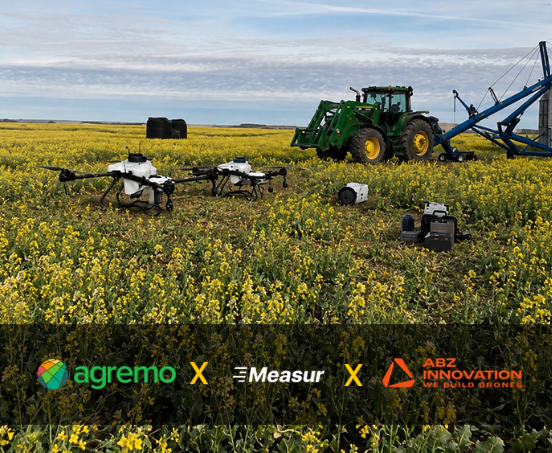
The Challenge: Why Spray 160 Acres When Weeds Cover Only a Fraction?
Traditional herbicide application often relies on uniform, full-field spraying. Whether weeds are widespread or concentrated in specific areas, the entire field may receive treatment. But weeds rarely grow uniformly.
For farmers, this creates several challenges:
- Unnecessary herbicide application in weed-free areas.
- Higher chemical, fuel, and water consumption.
- Additional operational costs.
- Potential crop damage caused by tractor wheel traffic.
- Limited ability to turn field imagery into actionable spraying instructions.
The challenge in this Canadian canola field was straightforward: identify where weed pressure existed and apply herbicide only where treatment was necessary.
The goal wasn’t simply to create a field map. It was to turn drone imagery into a precise, executable spraying operation that would reduce costs without unnecessary treatment.
Meet the Farmer Behind the Results
This project was carried out by Teri Ruecker, Precision Agriculture Specialist at Measur, based in Saskatchewan, Canada.
With 30 years of farming experience and six years helping farmers adopt drone technology, Teri understands both the realities of agricultural operations and the opportunities offered by precision agriculture. Her approach combines practical farming knowledge with technologies that solve real problems in the field. For this project, she used Agremo’s AI crop analysis and prescription mapping capabilities together with an ABZ spraying drone to demonstrate how targeted weed control can deliver measurable operational and financial benefits.
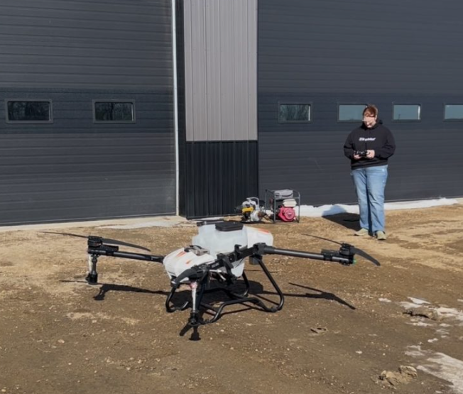
The Solution: From Drone Mapping to Precision Spot Spraying
The entire workflow connected field mapping, AI weed detection, prescription map generation, and drone spraying into one streamlined process.
Step 1: Map the Field with an RGB Drone
The 160-acre canola field was mapped using a DJI Mavic 3 Multispectral (M3M) drone, capturing RGB imagery only.
Mapping specifications:
- Crop: Canola
- Growth stage: Pre-harvest
- Weed: immature canola, foxtail, volunteer cereals
- Field area: 160 acres
- Drone: DJI Mavic 3M (RGB imagery)
- Ground resolution: 1.6 cm/pixel
- Image overlap: 78% / 71%
- Mapping flight time: Approximately 22 minutes
The high-resolution imagery provided the foundation for identifying vegetation patterns and locating areas requiring treatment.
Importantly, this workflow showed that RGB drone imagery can support AI-powered weed detection and targeted spraying without requiring multispectral analysis.
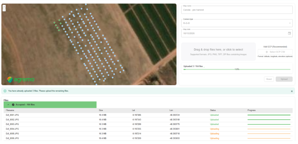
Step 2: Upload and Stitch Drone Images in Agremo
Once mapping was completed, the RGB images were uploaded to Agremo. Agremo’s cloud-based stitching technology processed the individual images into a georeferenced field map, ready for further analysis. This eliminated the need to manually combine hundreds of drone images using separate photogrammetry software. The result was a high-resolution map that could be used directly within the Agremo platform for crop monitoring and weed detection.
Step 3: Detect Weed-Infested Areas with AI
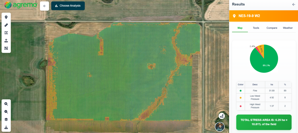
With the field map ready, the next step was identifying where herbicide application was actually needed. Agremo’s AI Weed Detection analysis was used to locate weed-infested areas across the field, including unwanted vegetation such as foxtail and volunteer cereals. Instead of relying on visual inspection alone, the farmer could use AI-generated spatial results to distinguish areas requiring treatment from areas where spraying could be avoided. The analysis results were available within a few hours.
The key discovery: only a small portion of the field required spraying.
This insight changed the entire application strategy. Rather than treating 160 acres uniformly, the farmer could focus the spraying operation on approximately 11 acres.
Step 4: Automatically Generate a Spot Spraying Prescription Map
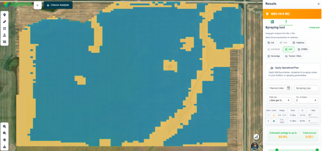
Identifying weeds is valuable. Turning that information into a spraying operation is where the real savings begin. Using Agremo, the weed detection results were converted into an automatic spot spraying prescription map, configured for the ABZ spraying drone.
For this operation, a 10 × 10 m tile size was selected, with two application zones:
- Zone 1 — Weed-infested areas: Maximum designated herbicide application rate.
- Zone 2 — Weed-free areas: Zero application rate. No spraying required.
This allowed the drone to apply herbicide only where the prescription map indicated treatment was necessary.
The prescription map was exported in a format compatible with the ABZ spraying workflow, connecting AI analysis directly to field execution. No manual drawing of individual weed patches was required.
Step 5: Execute Targeted Spraying with the ABZ L30
With the prescription map prepared, the spraying operation was completed using an ABZ L30 agricultural drone.
Spraying specifications:
- Spraying drone: ABZ L30
- Flight altitude: 5 m
- Sprayed area: Approximately 11 acres
- Spraying time: Approximately 40 minutes
- Herbicide: Dessica herbicide
Instead of driving a tractor through the entire field, the drone targeted only the areas identified in the prescription map. The result was a more selective herbicide application with substantially lower input consumption.
The Results: Less Spraying. More Savings.
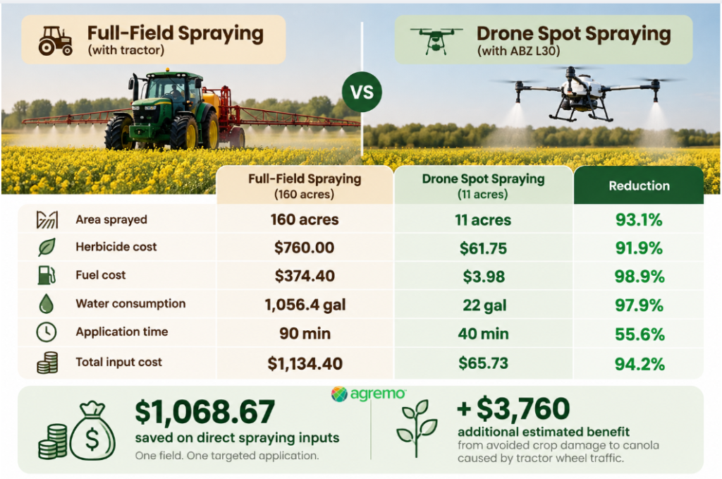
The Financial Impact: $1,068 Saved in Direct Inputs
The economic results highlight the potential of drone-based spot spraying for farmers looking to reduce herbicide costs.
1. 91.9% Lower Herbicide Costs
A conventional full-field application was estimated to require $760 in herbicide.
With targeted drone spraying, herbicide costs dropped to just $61.75.
That’s $698.25 saved on herbicide alone.
2. 98.9% Lower Fuel Costs
Conventional tractor spraying was estimated to consume $374.40 in diesel.
The drone spraying operation required approximately $3.98 in gasoline for the generator.
The result was a fuel cost reduction of 98.9%.
3. 97.9% Less Water Used
Full-field spraying would have required approximately 1,056.4 gallons of water.
Targeted drone spraying used only 22 gallons.
That’s a reduction of more than 1,034 gallons for a single field operation.
4. Faster Spraying Operations
The estimated tractor spraying time was 90 minutes.
The drone completed the spraying operation in approximately 40 minutes.
This represented a 55.6% reduction in application time, freeing up operational capacity for other field activities.
These time figures refer to spraying operations and do not include the entire mapping, processing, and planning workflow.
Beyond Input Savings: The Hidden Cost of Tractor Wheel Damage
Herbicide, fuel, and water savings are only part of the financial picture.
>When conventional tractors enter established crops, wheel traffic can damage plants and reduce the area available for harvest.
For this 160-acre canola field, an additional financial estimate was calculated using tractor specifications and assumed crop value.
Estimated avoided crop damage: $3,760
By using a spraying drone instead of driving through the crop, the farmer could potentially avoid this loss.
When combined with the direct spraying input savings, the total potential economic benefit becomes:
$4,828.67 in combined savings and estimated avoided crop damage.
This includes $1,068.67 in direct input savings and $3,760 in estimated crop damage avoidance. The crop damage component is a modeled estimate, not a measured yield improvement.
For farmers managing multiple fields, these results illustrate how targeted spraying could contribute to substantial seasonal savings, depending on weed distribution, application costs, crop conditions, and equipment.
Why This Matters for the Future of Precision Agriculture
Drone mapping alone doesn’t save herbicide.
Actionable data does.
The real value of precision agriculture comes from connecting accurate field information with practical farm operations.
This project demonstrates a complete digital workflow:
Drone Mapping → Agremo Stitching → AI Weed Detection → Automatic Prescription Map → ABZ Drone Spraying
By combining these technologies, farmers can move from uniform field treatment toward data-driven, targeted application.
The benefits extend beyond chemical savings:
- Reduce unnecessary herbicide applications.
- Minimize water and fuel consumption.
- Avoid driving heavy equipment through established crops.
- Improve spraying efficiency.
- Convert drone imagery into actionable field operations.
- Make more informed decisions based on actual field conditions.
Furthermore, this workflow enables drone service providers and agricultural contractors to offer higher-value precision spraying services, creating new business opportunities. Instead of offering only aerial imagery, they can help customers identify problem areas, generate prescription maps, and execute targeted applications.
From Drone Data to Real Savings: A Farmer’s Perspective
“The real value of Agremo is that it takes us from drone imagery to a ready-to-spray prescription map without complicated processes. What used to mean spraying an entire field can now be a precise, targeted operation. Saving over 90% on herbicide costs while protecting the crop from unnecessary tractor traffic is a game changer for farmers.”
— Teri Ruecker, Precision Agriculture Specialist, Measur
📧[email protected]; 🌐drones.measur.ca; 📞306-335-7879
Ready to Reduce Your Herbicide Costs with Drone Spot Spraying?
Whether you’re a farmer, agronomist, or drone service provider, Agremo helps you turn drone imagery into AI-powered weed detection results and ready-to-use prescription maps.
Map your fields. Detect weeds. Spray only where needed.