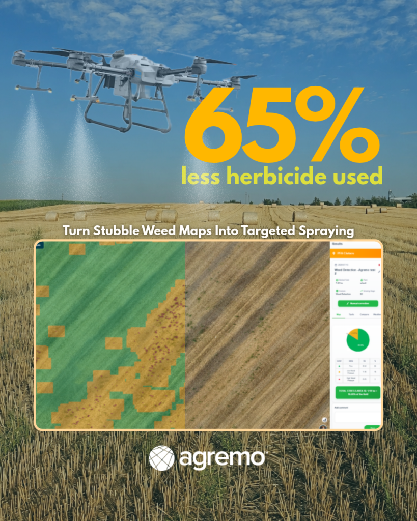
You can’t control what you can’t see. Mapping shows you where the weeds are in the stubble.
After harvest, uncontrolled weeds from the growing season are left behind in the stubble, including couch grass, johnsongrass, Canada thistle, and field bindweed. These are perennial weeds, with deep roots and rhizomes, and they’re exactly the ones that do the most harm to the following crop. The period right after harvest is the only window in which you can truly kill them — when they regrow and pull sap down toward the roots, a systemic herbicide travels down with it and destroys the whole plant, rhizome and all.
But before you spray, there’s a question few farmers can answer clearly: where exactly are the weeds on the field, and how much ground do they actually cover?
The problem isn’t the herbicide. It’s that you can’t see where to put it.
Perennial weeds aren’t spread evenly. They grow in patches — dense spots here and there, with a lot of clean ground in between. Johnsongrass and thistle start from one place and spread outward year after year.
Without seeing the real map of the field, you make decisions on something you can’t measure. That’s how you end up spraying uniformly: the same rate everywhere. You pay for herbicide on the clean ground too, where there’s nothing to control, and you put the same rate over a dense patch of johnsongrass as over a few volunteer plants.
What mapping gives you
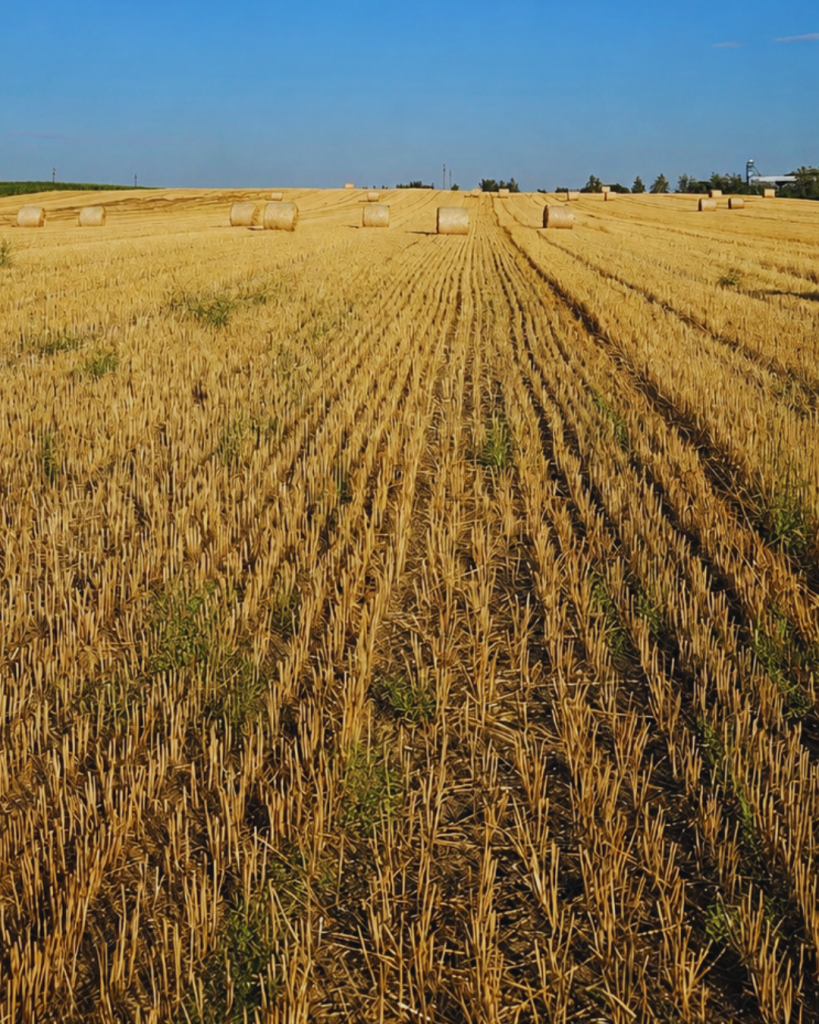
Here the stubble has an advantage a green crop doesn’t. The remaining straw is dry, yellow-brown. The weeds that regrow are green and actively growing. On a multispectral map, the green stands out sharply against the dry background; the patches where weeds have gathered show clearly. The stubble stage is, in fact, the best time of year to spot them from above.
Concretely, what you gain:
- You see the whole field at a glance. The drone covers tens of hectares in a few minutes. You no longer depend on what you happen to see walking the edge on foot — you get the picture of the entire field, including the middle zones you can’t reach.
- Not just “I have weeds,” but how much and where. The map shows what percentage of the field is actually infested. That turns a hunch into a figure — and on that basis you decide how much herbicide you need and how much you’d have wasted spraying uniformly.
- Fast, precise detection of the patches. Johnsongrass or couch grass patches appear outlined on the map, not hidden in the straw. You catch them while they’re small, when they’re still cheap to treat.
- The map stays with you. The same mapping tells you next year whether the patch shrank or spread. You get before-and-after proof that the treatment worked, and a record of the field from one season to the next.
One honest point: the map shows you where to look, not necessarily what is there. A quick check on the ground confirms whether it’s johnsongrass, couch grass, or just volunteers. The diagnosis remains the farmer’s job; mapping only makes it faster, more complete, and based on figures rather than a glance.
From the map to targeted application
Once you have the map, application is no longer done “the same everywhere,” but by zones, with a different rate depending on what you’re up against:
- Perennial patches (johnsongrass, couch grass, thistle) — full, effective rate. A perennial killed halfway regrows from the rhizome, so there’s no saving on the rate here.
- Light weeds (volunteers, annuals) — reduced rate. These die at much lower rates.
- Clean ground — no spraying. This is the real saving.
The map is, in fact, the prescription. Without it, variable-rate application wouldn’t even be possible.
Spot spraying is the simplest form of variable-rate application — treating on/off, herbicide on the weed patches and none on the clean ground. A full VRA prescription goes a step further, with different rates across zones (full rate on perennials, reduced on light weeds, zero on clean). The documented example below used spot spraying — and even that on/off approach produced a substantial saving.
Real-World Example: From Stubble Weed Mapping to 65% Less Herbicide Use
Field Overview
- Field size: 7.84 ha
- Crop: Wheat
- Target: Stubble weed control after harvest
- Goal: Apply herbicide only where weeds are present and avoid unnecessary treatment on clean areas.
The Agremo Workflow: From Drone Mapping to Spot Spraying
To create a precise weed management plan, the farmer used Agremo to map the field, detect weed-infested areas, and generate an application-ready prescription map.
- Capture drone imagery –> The field was mapped using RGB drone imagery. A resolution of approximately 2 cm/pixel provided the necessary detail to distinguish actively growing weeds from dry wheat stubble.
- Upload images and create the field map –> The raw drone images were uploaded directly into Agremo. The platform automatically processed the images and completed the stitching process to generate a high-resolution field map.
- Request AI Weed Detection analysis –> Once the map was generated, the farmer requested the AI Weed Detection analysis. Agremo’s AI analyzed the imagery to identify weed presence and highlight weed-infested zones across the field.
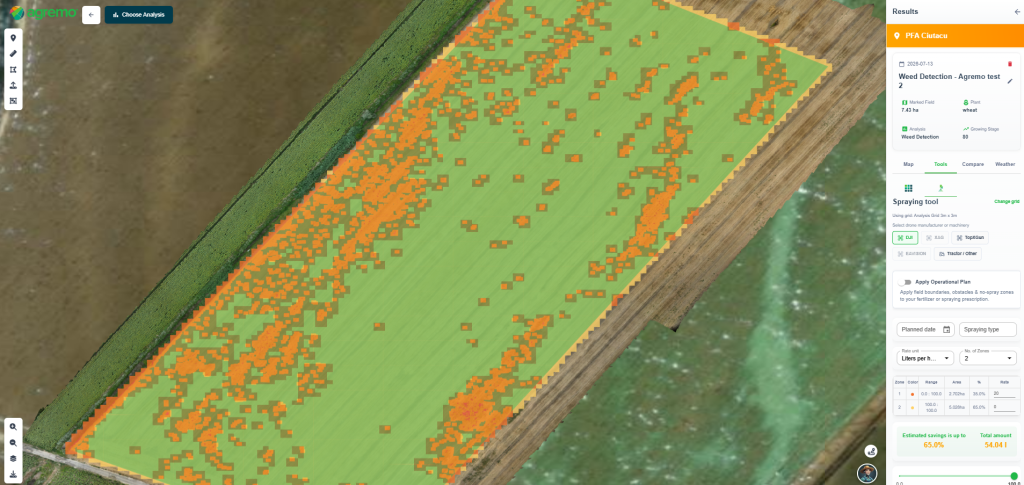
- Generate a prescription map for targeted spraying –> After the analysis was completed, Agremo automatically created a prescription map based on the detected weed areas. The map was configured for spot spraying, with the correct file format prepared according to the selected spraying equipment.
The final prescription map was ready to be exported and uploaded directly into the machine controller, enabling targeted herbicide application only where weeds were detected.
The Impact: Less Herbicide, Lower Costs, Smarter Weed Management
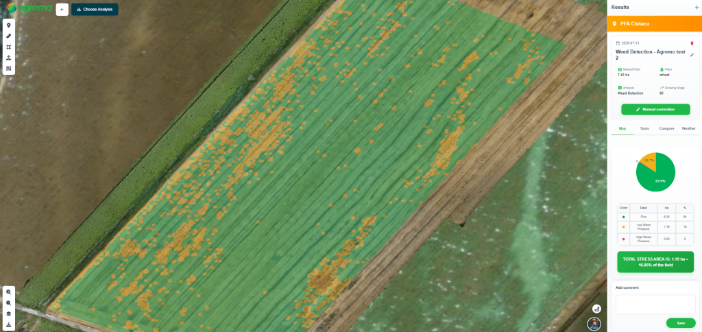
The AI Weed Detection analysis showed that 16.05% of the field area contained weeds. Based on the Agremo prescription map configured for spot spraying, the farmer achieved an estimated 65% reduction in herbicide treatment compared to uniform whole-field application. By treating only the areas where weeds were present, the farmer reduced unnecessary input use while maintaining effective weed control in stubble fields.
The agronomic gains behind the savings
Less herbicide is the visible benefit. The real value sits in the agronomy and it carries into the next crop.
Tillage doesn’t remove perennial weeds — it multiplies them
Johnsongrass, couch grass and thistle spread from rhizomes and root fragments. Plowing or discing cuts those rhizomes into pieces, and each piece with a node starts a new plant. A systemic herbicide does the opposite: it moves down into the rhizome and kills the whole plant. This is the one thing mechanical work cannot do.
You don’t have to give up the plow — just reorder the work
Treat first, wait two to three weeks for the herbicide to reach the roots, then till later, in cooler weather. You get both the systemic kill and the loosened soil, without the two working against each other — and tillage done out of the summer heat loses far less moisture.
The saving continues into spring
Perennials are expensive to fight once they’re up in the growing crop, where selective herbicides are limited. Draining the rhizome reserve in the stubble — on bare ground, at a full effective rate — means you enter spring with far less perennial pressure and a cheaper weed-control season. You move the fight from an expensive window to a cheap one.
The next crop starts on better ground
Not more yield from nothing — protected yield. Less early competition, moisture kept in the profile when tillage is delayed or dropped, and the green bridge for pests and disease broken. How much it’s worth depends on how infested the field was and how dry the year turns out.
And it compounds
A patch left alone grows every year; treated correctly, it shrinks every year — less weed, less herbicide, lower cost next season. Put this year’s map next to last year’s and the patch is visibly closing in. From there, mapping becomes monitoring: you catch a new patch while it’s still small.
The profit is in doing it by the book — digitally
On their own, none of these is dramatic. Together they are three streams that add up on the same hectare: less herbicide, cheaper spring weed control, and a crop that starts on clean ground with moisture in the soil. On a problem field, that moves the margin. Done this way, the treatment also means a lighter load on the land — input placed only where it’s needed, full rates that don’t breed resistant weeds, less soil disturbance. Good agronomy and a smaller footprint turn out to be the same thing here.
What makes it all add up is the digital workflow. The drone map, the AI weed detection and the prescription the machine executes are what turn “there are weeds out there somewhere” into “treat exactly here, at exactly this rate.” The agronomy was always true, digitalization is what lets you finally act on it with precision. And on a thin per-hectare margin, precision is where the profitability is. The potential gain depends on your field and the season, which is why growers map their fields first before deciding where and how much herbicide to apply.
One thing to clear up
Stubble herbicide treatment happens after harvest, when growers apply herbicides to weeds left in the stubble. This legal and routine operation is different from pre-harvest desiccation, where farmers spray standing crops to speed up drying, a practice that is no longer permitted.
See first, decide after
There’s no point guessing how much of the field is infested.
“Digitalization is quietly changing what’s possible on a farm. Mapping turns a guess into a figure — you stop spraying blind and start treating exactly where it’s needed. On the thin margins of arable farming, that precision is real added value.”
— Paul Dorobantu, Founder, Zyntra
[email protected]