Supported File Types
Orthophoto – a map (GeoTIFF) already stitched in another system.
Raw images – georeferenced images that will be processed in the platform.
Upload Options
From the computer – upload files directly from your device.
Via public link – paste a link to access and upload files.
File Formats
Zipped folders – compressed files in .zip format
Unzipped folders – regular folders containing georeferenced images
Supported Image Types
RGB
Multispectral
Note: When using a DJI M3M drone with RGB and multispectral (MS) cameras, raw images can be uploaded together. Separating RGB and MS files is not required.
Upload a map directly from your device
Uploading a File
A file containing one or more folders can be uploaded. ZIP files must not include another ZIP inside.
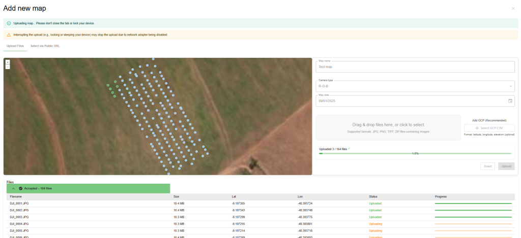
When an unzipped folder is uploaded, small dots appear on the left side, representing the locations where the images were taken.
Viewing Image Details
At the bottom of the screen, the total number of images contained in the uploaded folder is displayed.
By clicking the down arrow, the user can expand the list to see details of each image, along with its upload progress.
Image Upload Status
While uploading, each image is represented by a dot:
Blue dot → Image pending or in progress.
Green dot → Image successfully uploaded.
Adding Missing Images
If stitching stops or some images are missing, you can return to the map loading modal to add them. Any images already uploaded will be automatically skipped.
Note: The system displays image locations and details only when an unzipped folder is uploaded. This information is not available for ZIP files.
Upload a map via public link
The URL must be publicly accessible, meaning anyone with the link can view and access the file.
Upload maps from the following sources:
- Google Drive – https://www.google.com/drive/
- Dropbox – https://www.dropbox.com/
- OneDrive – https://www.microsoft.com/en/microsoft-365/onedrive/online-cloud-storage

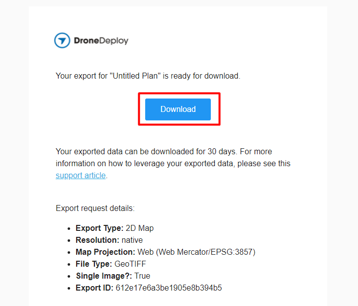
Finally, If you want to export a map from DroneDeploy to your email, you will get a link that you can copy and upload to Agremo (right-click on the Download button and copy the link to Agremo).
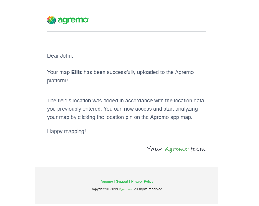
Agremo will notify you by email and in the app (under the Notifications tab) once your map upload is complete.
Further, you can find your map by clicking the Field list icon in the top bar:
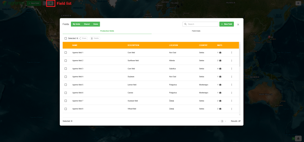
To request an analysis, open the field you want to analyze, select the map for which you want to request the analysis, and follow the full process described in the provided link.
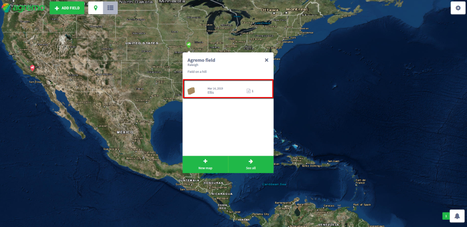
Another way to access your map after uploading it is to click the pin on the app home screen:
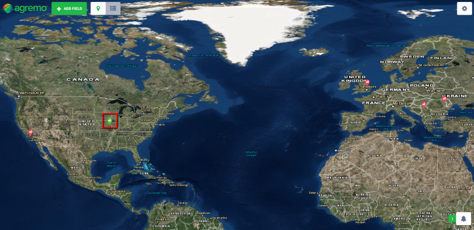
Then, a window with all the maps of the field will appear. Click on the map you want to analyze.
