Zone management

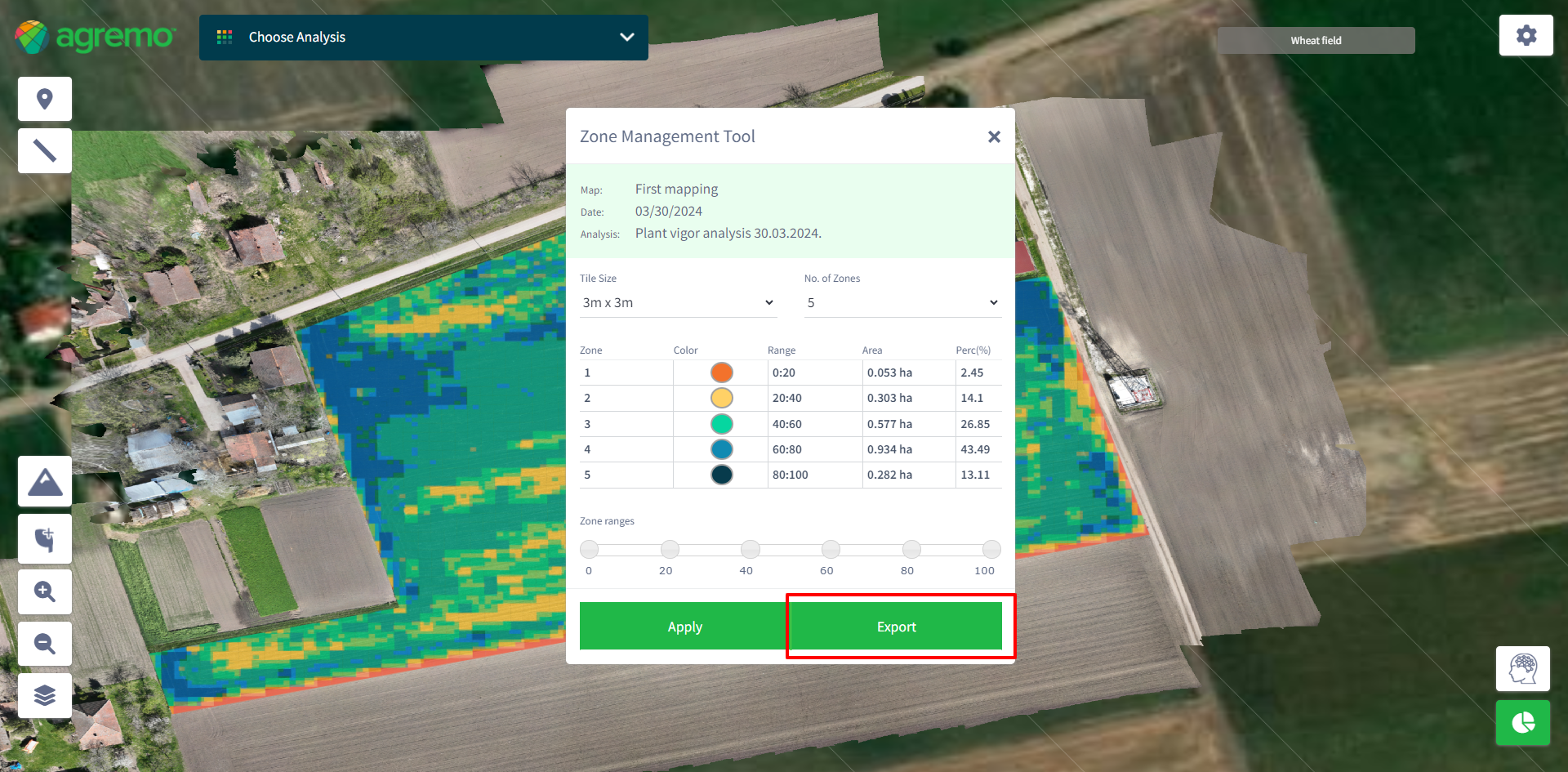
Manage and analyze different zones based on plant health and count within your fields.

Step 1

Open the map displaying your analysis results.
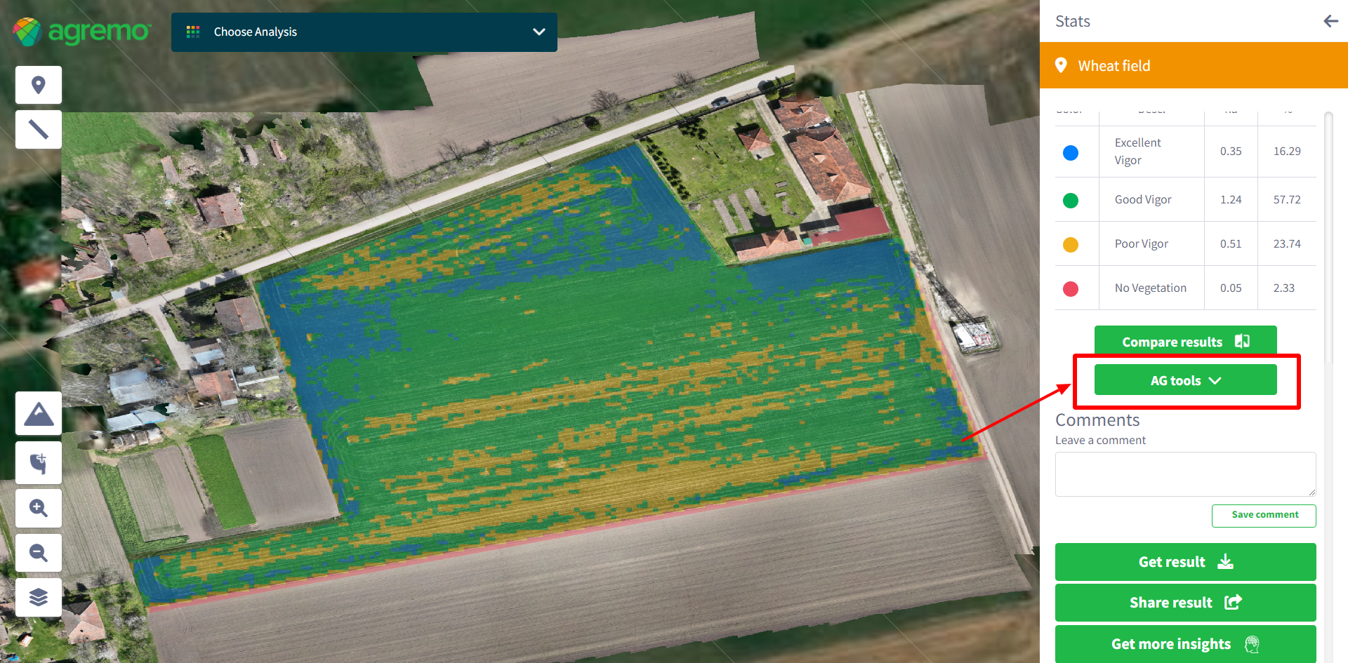
Step 2

Click on the “AG Tools” button.
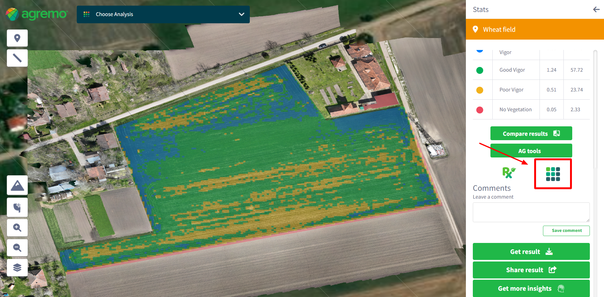
Step 3

Select “Zone Management Tool” from the menu.
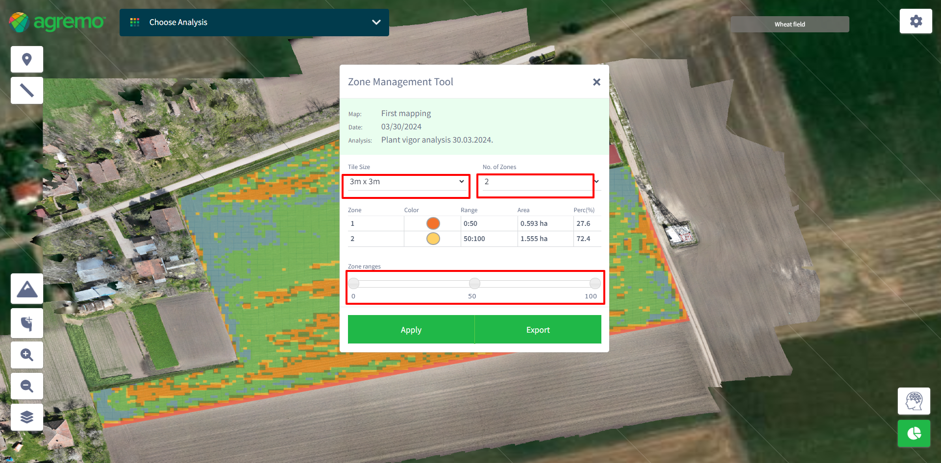
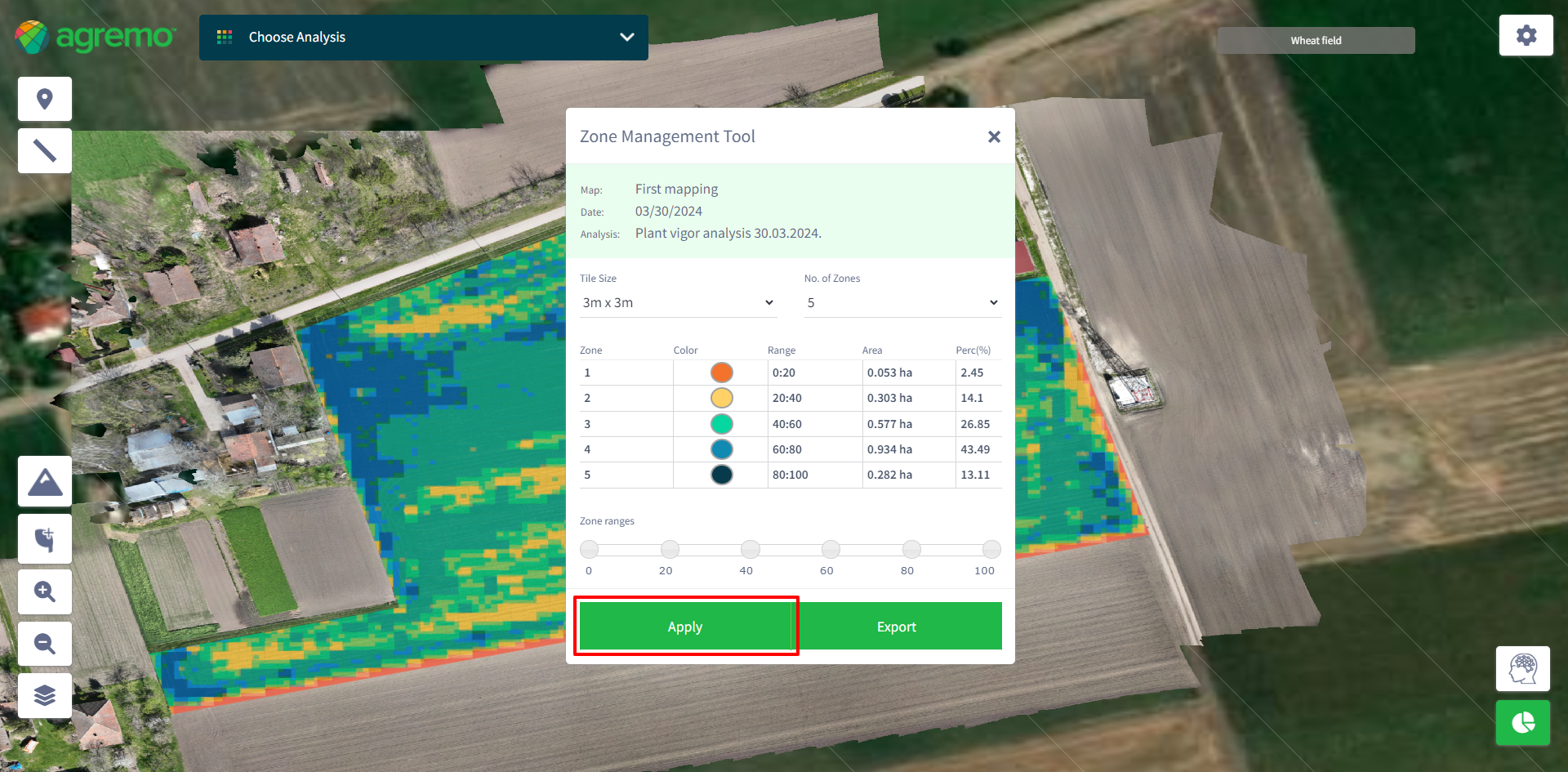
Step 4

Set the parameters in the tool:

    • Tile Size: Choose from 3×3, 10×10, or 20×20.
    • No. of Zones: Select between 2 and 5 zones.
    • Zone Ranges: Adjust sliders to set specific ranges for health or count (Health zone range represents the health percentage per zone, and the Counting zone range represents the number of plants per hectare in each zone)

Step 5

Click “Apply” to see changes reflected on the map.
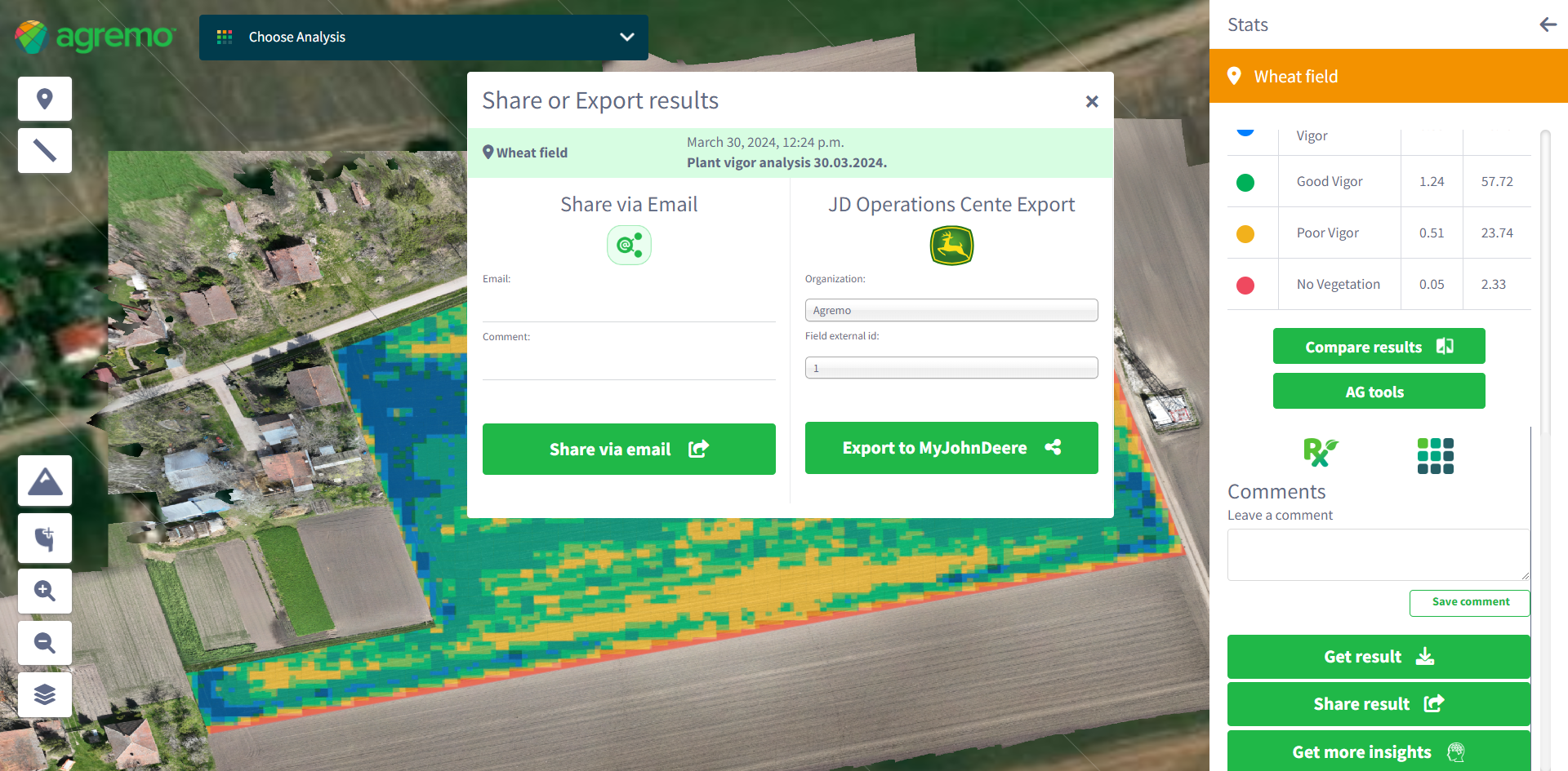
Step 6

Click “Export” to open the modal for sharing via email or exporting data (JDOC, PNG, PDF report, RX file, SHP file).


What our partners are saying

GET A DEMO

DJI Agriculture

Agremo's AI solution turns DJI's drone imagery into actionable insights, and its recipe maps make our AGRAS drone a truly intelligent and precise spraying tool." The integration of the Agremo platform between Agremo and the DJI drone is a turnkey solution for precision agriculture.

Ciprian Iorga

The biggest benefit for farmers who use drones and Agremo reports is that they increase their yields, reduce costs or improve their productivity. In the end, all these benefits are lead to extra profits.

Zdravko Hojka

Agremo Stand Count analysis shows how successful seeding was and how many plants farmers will be able to harvest. Withal, it can help to apply different sowing standards in different parts of the plot, in order to achieve the highest yields.