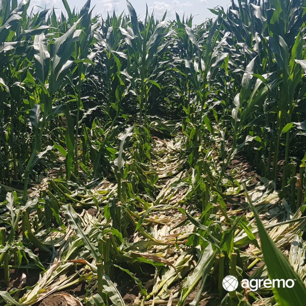
A powerful windstorm can cause severe green snap damage in corn fields, leading to broken stalks and significant yield loss.
According to research from Kansas State Agronomy eUpdate, green snap and root lodging can cause an estimated 0.5–1.0% yield loss for every 1% of plants broken.
Identifying these damaged areas quickly and accurately is essential for crop management and insurance reporting.
Our partner Volitant Drone Technology, a precision agriculture service provider, used Agremo’s AI-powered Green Snap Detection analysis to map and quantify corn damage caused by the windstorm. The analysis provided an accurate, data-driven view of the affected area—helping the grower focus field scouting efforts and streamline the insurance adjustment process.

Corn Field and Drone Flight Details
- Field area: 52.87 ha
- Crop: Corn
- Growth stage: R1
- Cause of damage: Windstorm with gusts around 30 mph
- Date of event: July 5th
- Drone flight: July 15th (10 days after the storm)
- Drone and parameters: DJI Mavic 3 Multispectral
- Altitude: 400 ft (AGL, Terrain Follow ON)
- Speed: 33.5 mph
- Front overlap: 80%
- Side overlap: 70%
- Photo mode: Timed interval shot
AI Green Snap Detection Results in Corn Field

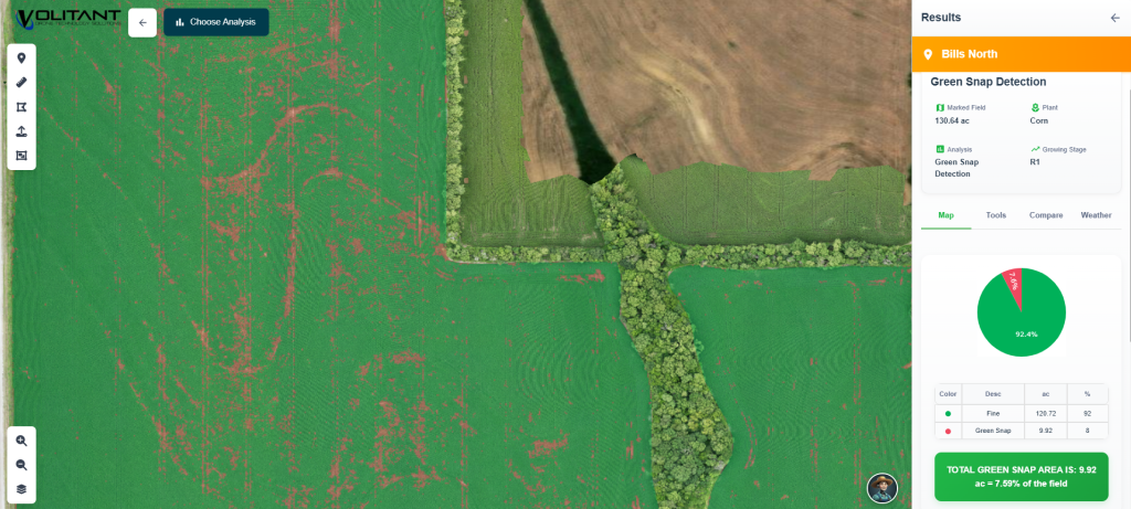
The AI Green Snap Detection analysis revealed:
- 92.41% of the field was undamaged
- 7.59% of the field showed visible green snap damage (~4 ha)
With this insight, the grower could instantly visualize the windstorm impact across the entire corn field, identifying the exact location and extent of the damaged zones.
Key Benefits of Using AI for Green Snap Detection
Thanks to Agremo’s AI Green Snap Detection in corn, the farmer and agronomist were able to:
✅ Locate damaged areas precisely without walking the entire field
✅ Save time and costs by directing scouts only to affected zones
✅ Improve accuracy for insurance claims and crop damage assessment
✅ Make faster, data-backed decisions using drone and AI insights
Instead of spending hours manually scouting 52 hectares, the Volitant Drone Technology team used drone flights with Agremo AI-generated maps, accurately pinpointing the 4 hectares of damaged corn. This approach reduced scouting time by over 80%, ensured precise insurance assessments, and allowed the adjuster to focus only on the affected areas.
Comparing AI Green Snap Detection vs. Traditional Field Scouting
Before using Agremo’s AI analysis, assessing green snap in corn relied on manual scouting and visual estimation — a time-consuming and often inaccurate process. Even with a thorough field inspection, many damaged areas could easily be overlooked.
With Agremo’s AI Green Snap Detection, the client received a clear, visual damage map, helping target on-ground checks only where necessary:
- Manual scouting estimate: 8–22% damage
- Insurance adjustment: 28%
- Agremo AI analysis: 7.59% precisely mapped
This demonstrates how Agremo AI Green Snap detection enables reliable, objective, and data-driven decision-making in precision agriculture.
Volitant Drone Technology Feedback
“Using Agremo’s AI Green Snap Detection made it incredibly easy for us to pinpoint damaged areas. It also helped us guide the insurance adjuster efficiently.. It saved us time and gave our client full confidence in the assessment.”

